
Water is an integral part of life to the Navajo Nation. However, drought emergencies are increasing.
The Navajo Nation is the largest federally recognized Native American Nation in the United States, with a land area encompassing 70,000 square kilometres at the nexus of Arizona, New Mexico and Utah. It comprises 110 chapters, five Navajo Nation Agencies and a total population of 200,000 people. This region is geographically diverse, ranging from deserts to snowy forests, though the majority is a semi-arid or arid landscape. Water is an integral part of life to the Navajo Nation and they have observed increased drought, which is adversely affecting their lives. Households are impacted through access to drinking water being limited, requiring many to truck water in from miles away. The Navajo manage over 212,000 acres of farmland that produce $92 million in agricultural products annually. Water availability is essential for the success of their crops and livestock. Despite this vital need, it is challenging for the Navajo to manage water resources while experiencing frequent droughts, varying precipitation patterns, and impacts from climate change, such as increasing temperatures. Drought emergencies are also increasing, costing governments and businesses alike millions of dollars to provide solutions.
Dataset
Overview
- United States
- 2.5km-50km
- Variable (14 day - 5 year)
- gridMET, PRISM, RTMA, CFS, ERA5, MERRA2, Terra Climate, CHIRPS, USDM, NADM

For the past 10 years data was generated at the regional scale; however, it lacked specifics to the unique and diverse climates throughout the Nation. The Navajo utilized data from 85 rain gauges and three satellites from NASA’s Western Regional Climate Center. Gathering data this way was very time-consuming and provided limited information for the entirety of the expansive, geographically diverse region. When drought emergencies occurred, relief funds were distributed evenly amongst the Nation’s 110 chapters. However, this did not account for regions that were more affected, or had less water than others, because they did not have the data to identify who was most impacted by that specific drought emergency.
The Drought Severity Evaluation Tool
As a result of the increased droughts, a more detailed local tool was required to assist in water management and decision making. In 2020, the Drought Severity Evaluation Tool (DSET) was completed. This project is a collaboration between the Navajo Nation, the Desert Research Institute (DRI) and NASA’s Western Water Applications Office. It is a web-based drought reporting tool that displays and combines precipitation data from NASA satellites, drought indices and on-the-ground rain measurements. DSET uses the Climate Engine platform to allow its users to analyze data and create customized maps and visualizations on-demand to suit unique purposes, without the usual complexity of working with technical Earth observation data. As a result, this tool easily generates data that is applicable to the local scales of the Navajo chapters and agencies.
DSET was built entirely for the needs of the Navajo Nation, and it incorporates both Indigenous and western science knowledge. The extensive collaboration and communication between the Navajo Nation and DRI & NASA scientists was a key component to DSET’s success, since the entire project was structured to fill the gap in their data needs. This tool is critical to ensuring that they have the best information required to make essential water decisions for their communities.
Figure 1: The Drought Severity Evaluation Tool
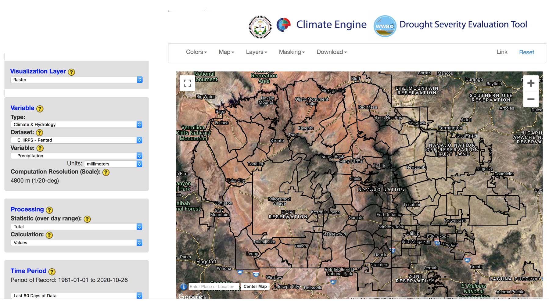
Figure 1: The Drought Severity Evaluation Tool showing the Navajo Nation boundaries and the 85 rain-gauge locations. This map displays the CHIRPS-generated Standardized Precipitation Index (SPI) values from June to August 2018. The data underscores the variability of the SPI across the Nation, particularly during the monsoon season.
Climate Engine has enabled DSET to become a completely new way for the Navajo Nation to conduct land and agricultural management. DSET allows virtual calculations of historical or current precipitation levels for any area in the region, without requiring someone to manually check a rain gauge on the ground. Instead, it combines the most accurate and longest monitoring rain gauges with the remote sensing data from satellites to provide enhanced accuracy of measurements.
DSET enables the Navajo Nation to:
- Improve their overall ability to monitor and report on drought;
- Declare a drought emergency in specific regions faster;
- Distribute relief funds for drought emergencies more effectively by quantifying regional differences in water availability and distributing funding accordingly;
- Generate reports and maps to better plan for the future;
- Perform crop analyses;
- Monitor the status of lakes and snowpacks.
Drought Monitoring in the Future
As of January 2021, beta testing of DSET has occurred and further modifications have been made. There are also potential future uses for drought mitigation, streamflow diversion mapping, managing water infrastructure and restoration efforts.
DSET requires less time and resource intensive on-the-ground analytics, and compiles more local data sources to ensure that the Navajo Nation has the best available knowledge to make critical decisions about their most crucial natural resource: water.
Further Reading
Related Stories

Managing Public Lands from Space
Dataset
Landsat NDWI (NIR/SWIR1)
North America • Infrastructure & Transportation
Greenland Western Coast
United States Geological Survey


© 2025 Climate Engine
All rights reserved worldwide.